Springs Trail
See trail guide below ... click on camera icons for photos at that location.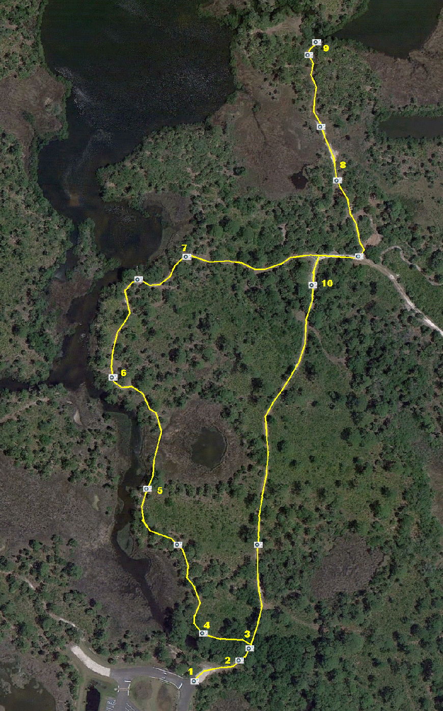
The Springs Trail takes you on tour of two springs in Werner-Boyce Salt Springs State Park - Cauldron Spring and Salt Spring. This is the most scenic of all the trails, and is about a mile for the entire trip.
- Trail head for the Springs Trail is at the northeast corner of the main parking area.
- Cross over the creek whose primary source is Cauldron Spring. The outlet of the spring is under the culvert at the west side of the path.
- The Springs Trail splits into a west and east branch. The east branch is shorter and is currently to only way to hike to Salt Spring. The west branch is more scenic, but is presently closed just after observation point 5 where it crosses a marshy area. A boardwalk is planned for this area.
- A good observation point just downstream from Cauldron Spring.
- View of Cauldron Spring Run. From here you can see a mix of fresh water grasses and salt water needle rush - both able to survive here because of the fresh water discharge of the spring and the tidal flow from the Gulf.
- This is the point where Cauldron Spring Run joins Salt Spring Run. The current here can be swift during tide changes.
- A scenic overlook of Salt Spring Run to the west and north.
- A low lying tidal marsh to the north of this point may be wet at times. A boardwalk is planned at this point.
- Overlook of Salt Spring. The spring flows from a cavern system that has been explored to a depth of 320 feet. After emerging from Salt Spring, the water flows through two limestone arches just downstream that are only visible at low tide. Please note that swimming and scuba diving is prohibited in the spring. All visitors must stay on the marked trail.
- The east branch of the Springs Trail heads south to the parking area.